

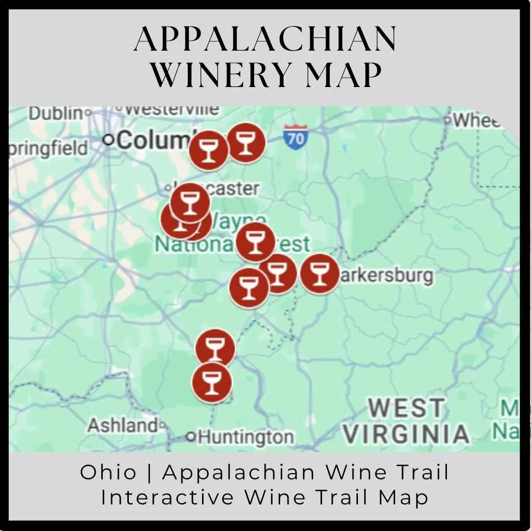
Capital City Winery Map
Ohio | Columbus | Capital City Wine Trail
Discover Ohio’s Capital City Winries with Our Interactive Wine Trail Map
Discover the vibrant heart of Ohio’s wine country with our Interactive Capital City Wine Trail map, your ultimate guide to exploring the wineries in and around Columbus. This detailed Columbus winery map is a comprehensive Ohio winery map showcase some of the finest Ohio wineries, from boutique urban tasting rooms to scenic countryside vineyards. Whether you’re planning a casual afternoon outing or a full weekend wine adventure, our interactive map makes it easy to navigate the Capital City Winery Trail, find hidden gems, and enjoy the rich flavors and warm hospitality that define Ohio’s growing wine scene.
Featured Wine Travel Tips


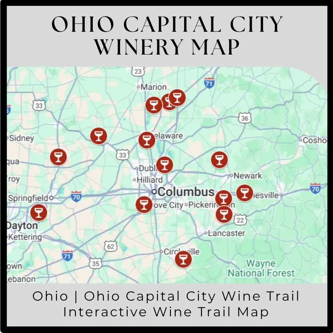
Interactive Ohio Capital City Winery Map
perfect Buckeye State wine getaway.
Why Use the Interactive Ohio Capital City Winery Map?
Our Interactive Ohio Capital City Winery Map isn’t just another directory; it’s a fully integrated tool designed to simplify your Ohio winery tour planning. With just a few clicks, you can access everything you need to curate your ideal wine-tasting experience.
Comprehensive Winery Listings: This map is one of the most detailed resources available, featuring every winery across the Ohio Capital City wine region. No matter where you are or what type of wine you’re craving, you’ll find a destination that suits your taste.
Interactive Features: Click on any winery icon to instantly view directions, contact information, ratings, and more. The map makes it easy to discover new spots and revisit old favorites with confidence, knowing the best-rated and most-loved wineries are right at your fingertips.
Mapped Directions: Once you’ve chosen your must-visit wineries, getting there is a breeze. Click any winery’s icon to pull up mapped directions, ensuring you never miss a stop along the way. Whether you’re planning a quick afternoon of tastings or a multi-day wine trail adventure, this tool helps you navigate the region with ease.
Ohio Winery Maps


How to Use the Interactive Wine Trail Map
Our Interactive Ohio Capital City Wine Trail Map is designed to be user-friendly, whether you’re planning your trip on a desktop or on the go. Here’s how to make the most of this powerful tool:
Pinterest Integration: If you’re a Pinterest user, save the map to a board for easy access during your trip. Use the Pinterest icon at the top of this page.
Mobile Phone Convenience: For quick access, create a Guided Wino shortcut on your phone’s home screen. Though Guided Wino doesn’t have a dedicated mobile app, our website is fully optimized for mobile use. By adding a shortcut, you can operate it as a mobile app. If you’re visiting the Sierra Foothills wine region, we suggest creating a shortcut to the Guided Wino Ohio Wine Travel Guide for easy reference.
Once you have the map open, you’ll see all the wineries listed in the Ohio Capital City wine region including a map. Tap any icon to view essential details like the winery’s name, address, website, and Google rating. For more in-depth information, click “View in Google Maps” to access:
Map directions
Contact information (address, phone number, website)
Winery hours
Reservation links
Winery reviews
Photos of the winery
Finally, save your favorite wineries to your Google Maps to start building out your personalized Ohio winery tour.
Plan Your Ohio Wine Tour Today
Whether you’re a seasoned Ohio visitor or planning your first trip, our Interactive Ohio Wine Trail Maps are your go-to tool for creating an unforgettable wine-tasting experience.
Do you see a winery missing or have a suggested updates? Please contact us here